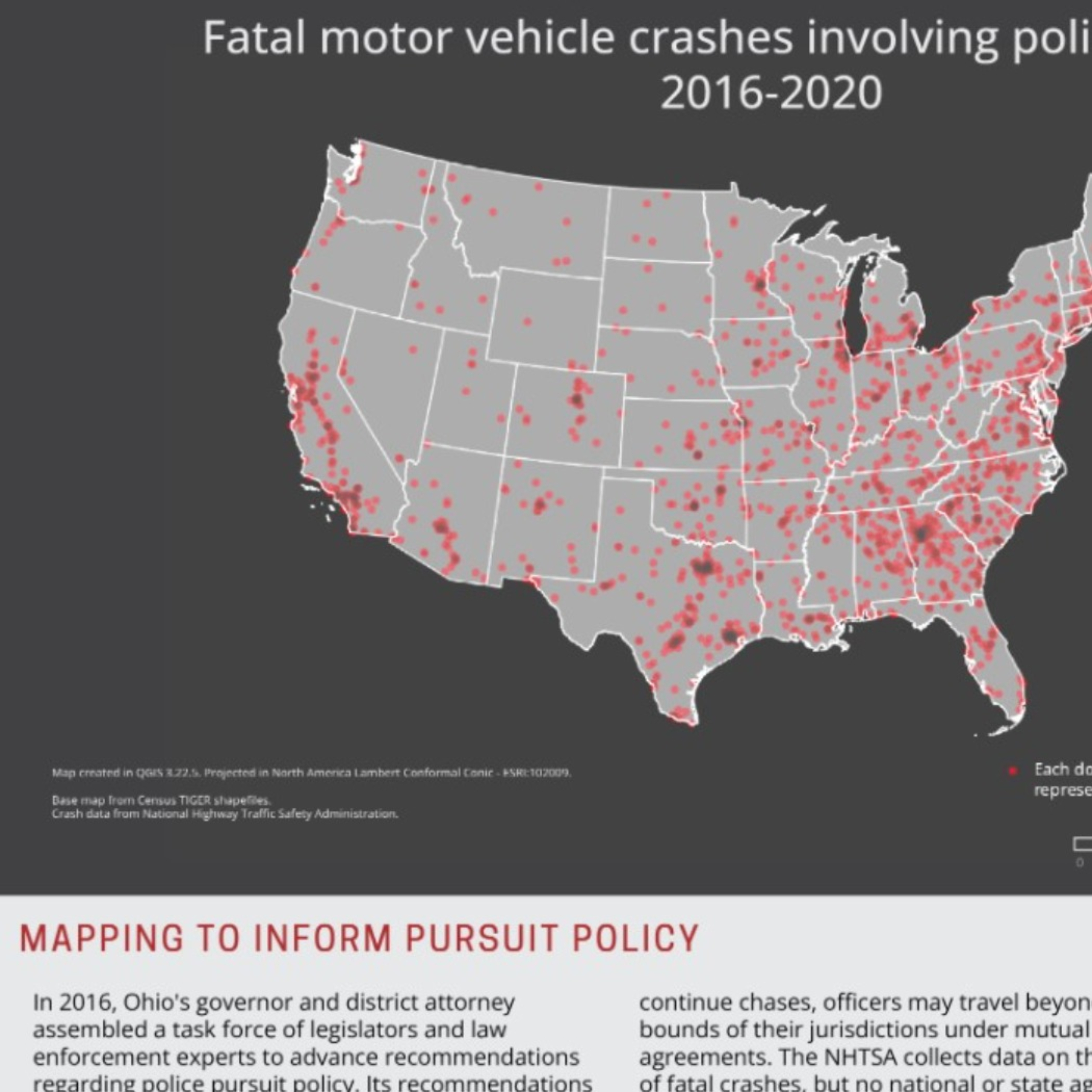
Mapping Police Pursuits
Maps traffic fatalities involving police pursuits, using NHTSA data, and suggests mapping as a tool to further study pursuit-related fatalities. Map created QGIS 3.22.5. The basemap uses OpenStreetMap and Census TIGER data. Poster created in Adobe Illustrator.
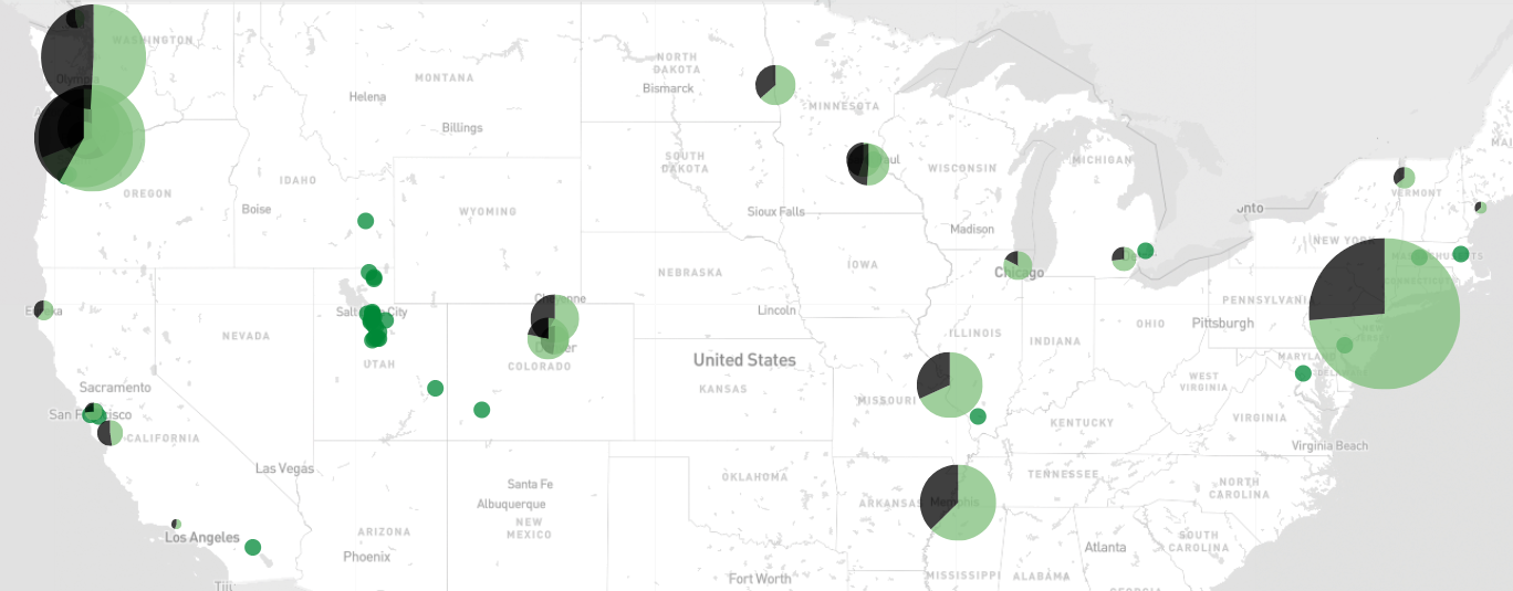
Ranked Choice Voting Initiatives
Ballot initiatives on RCV or approval voting, and placed on the ballot between 2018 and 2022, are mapped using pie charts on this map.
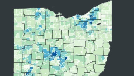
Median Incomes of Ohio School Districts
Static chloropleth map showing median household incomes of Ohio's school districts. Map created using Leaflet. Data from the Ohio Department of Education's 2018 District Profile Report.
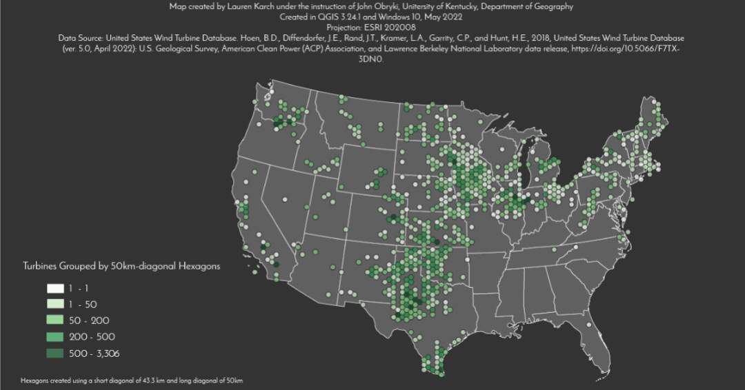
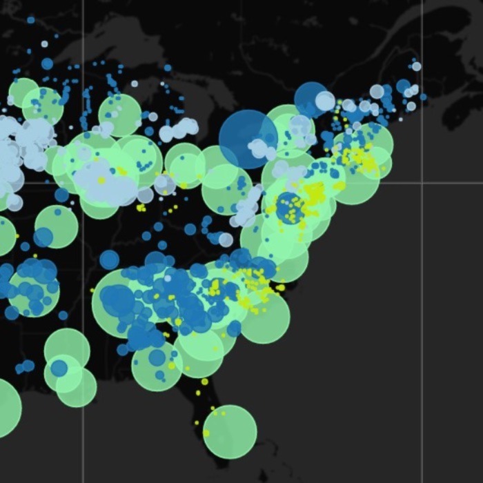
Concentration of Wind Turbines
Static hexbinned map showing concentration of wind turbines in the United States. Data from United States Wind Turbine Database.
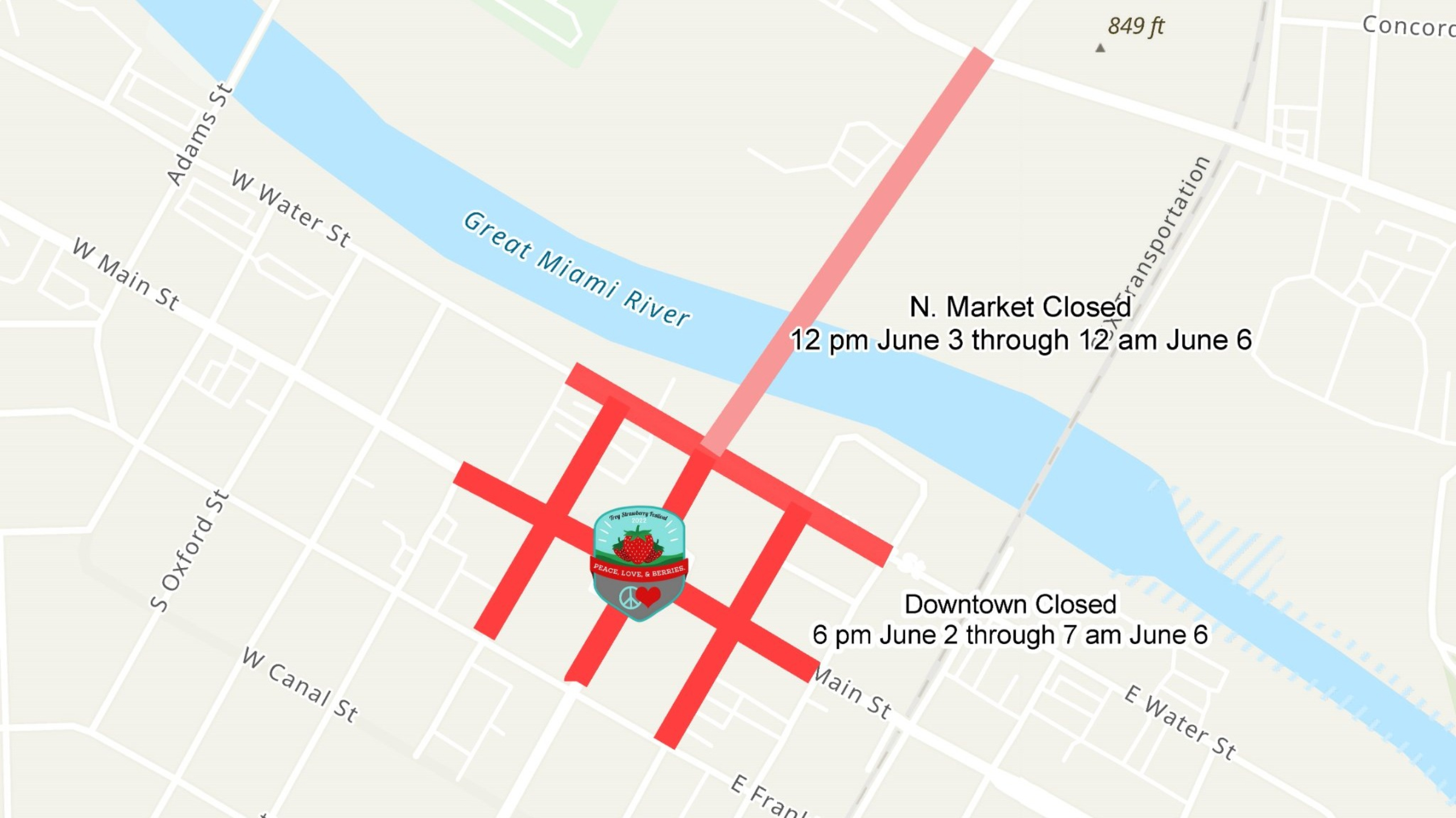
Troy Ohio Road Closures (Contributor)
Rudimentary ArcGIS StoryMap allowing collaboration across City departments, and accessible to residents.
Power Plant Sources
Interactive Leaflet map showing power source for power plants across the United States.
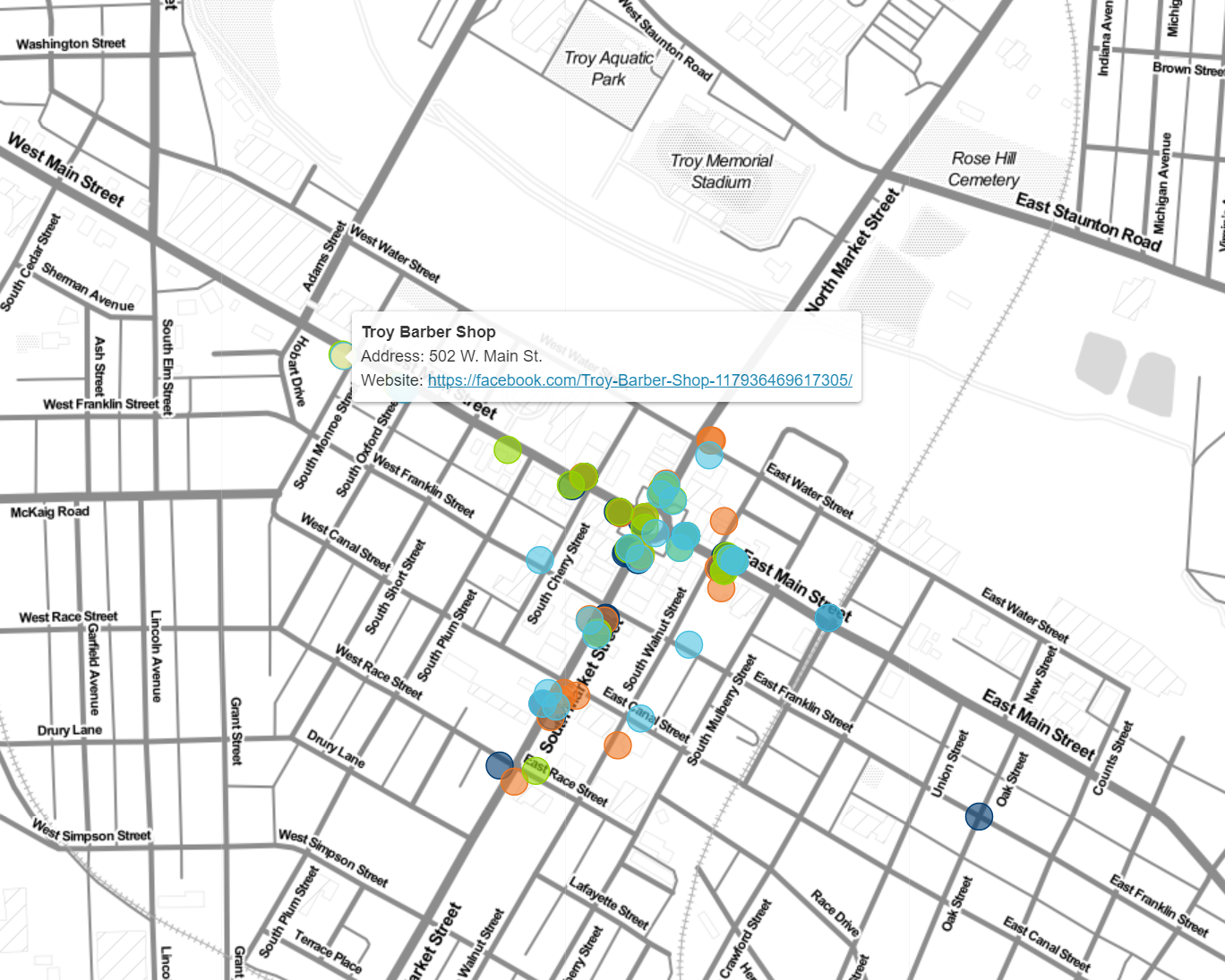
Troy Main Street Map
Interactive Leaflet map showing local businesses.
